Home
Geothermal Rising :: Using the Earth to Save the Earth
Using the Earth to Save the Earth

Main navigation

  • Our Organization
    • Mission and Vision
    • Membership
    • Our Members
    • Board of Directors
    • Staff
    • Committees
    • U.S. Policy Council
    • Canada Policy Council
    • Student Committee
    • Contact Us
    • Advertise
    • Media Kit
  • Our Impact
    • Bulletin Blog
    • Regional Interest Groups (RIGs)
    • GR Museum Exhibit
    • Full Steam Ahead Webcast Series
    • Honors & Awards
    • In the News
    • Workforce Success
  • Resources
    • Find Our Resources
    • Geothermal Basics
    • Frequently Asked Questions
    • Geothermal Power Production
    • Direct Use Geothermal
    • Geothermal Ground Source Heat Pumps
    • Geothermal Directory
    • Geothermal Calendar
    • Student Resources
    • Job Board
    • Library
    • Video Library
  • Events
    • Conferences
    • Webinars
    • Workshops
    • 2025 Geothermal Capitol Hill Day
    • 2025 Geothermal Investment Forum
    • 2025 Geothermal Rising Conference
    • 2025 Indigenous Geothermal Symposium
  • Take Action
    • Join Us
    • Donate
    • Receive the newsletter
    • Sponsorship & Advertising
  • Member Login

A Clash of Civilizations?

Submitted by bschmidt on May 05, 2021
  • Read more about A Clash of Civilizations?
Date
May 05, 2021
Regional Overviews
Image
sunrise
Quote
You can best serve civilization by being against what usually passes for it.
Attribution
Wendell Berry

If you've worked in the geothermal industry for a decade or more, you’ve invariably spent large chunks of time in out of the way places.  And to get to these places generally required hours of driving with colleagues whose company ranged from surprisingly enjoyable to never-ending.  A great conversation topic that lets the miles roll by is ranking the best highway drives. Which routes would you recommend to others for the scenery alone?

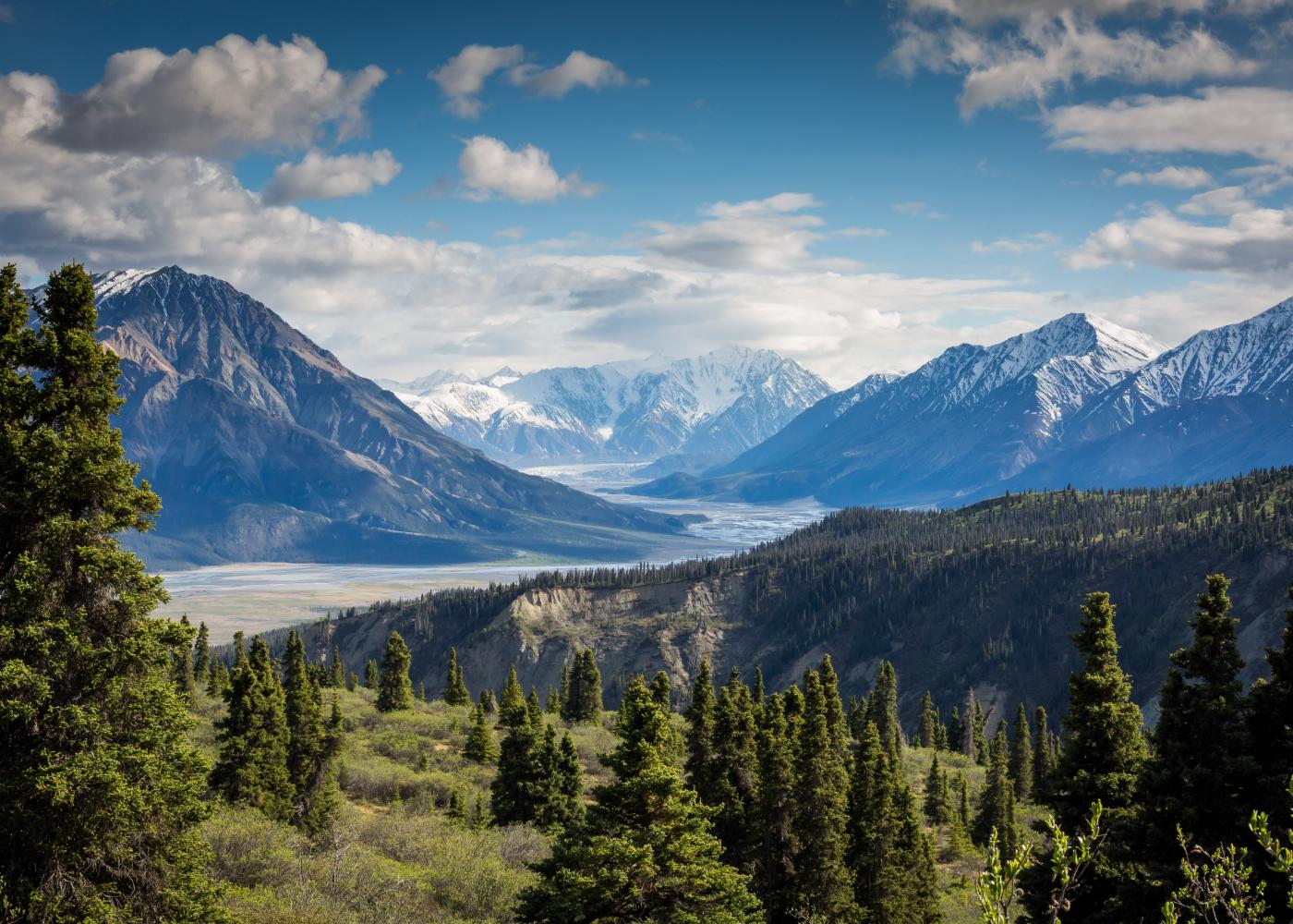
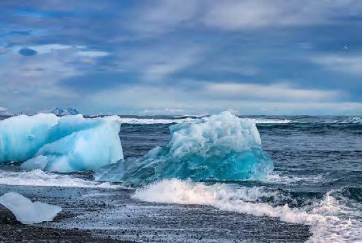
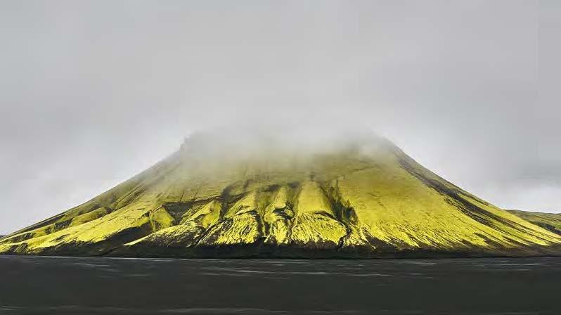
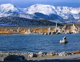
Over the years I have developed a strong bias for most roads west of Denver.  A favorite drive is out of the Mojave desert, north on CA Route 395 as it hugs the eastern Sierra Nevada en route to Reno and beyond.  Stunning sites almost everywhere on this frequently undivided road include imposing granite walls of the >10,000 foot Sierra Nevada, high alpine meadows and pine forests near Mammoth Mountain, and the expansive Mono Basin centered on Mona Lake with its nearby young volcanic landforms and iconic tufa towers (Figure 1). Just west of Mono Lake is Tioga Pass, the back door to Yosemite National Park. And east of that is 1,000 miles of broad, windy and barren deserts of the Basin and Range province.

Image
Mono Lake with high Sierras in background to the west.
Caption
Figure 1. Mono Lake with high Sierras in background to the west. The white pinnacles in and around the lake are tufa towers.

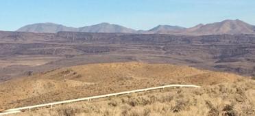
A nondescript portion of Rte. 395 where no one stops for pictures is about 30 minutes north of Inyokern, California, several hours south of Mono Lake. Rose Valley is bordered to the west by the southern end of the high Sierra and to the east by a low set of hills and mountains, difficult to see at 75 miles an hour, called the Coso Range. A little appreciated fact is the Coso Range has been a focus of civilizations for millennia. 

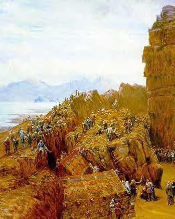
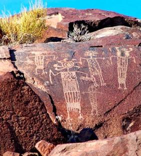
The densest accumulations of rock art in North America exists in the Coso Range.  These mountains are also home to the Coso volcanic field.  Archeological investigations of petroglyphs and associated features demonstrate that aboriginals probably came to this region over 13,000 years ago. They lived in small settlements, were largely nomadic and came and went over time. Nothing is known about their cultures or how they lived beyond inferences made by archeologists from artifacts found and studied. A common thread over these thousands of years of is the fixed location of the rock art.

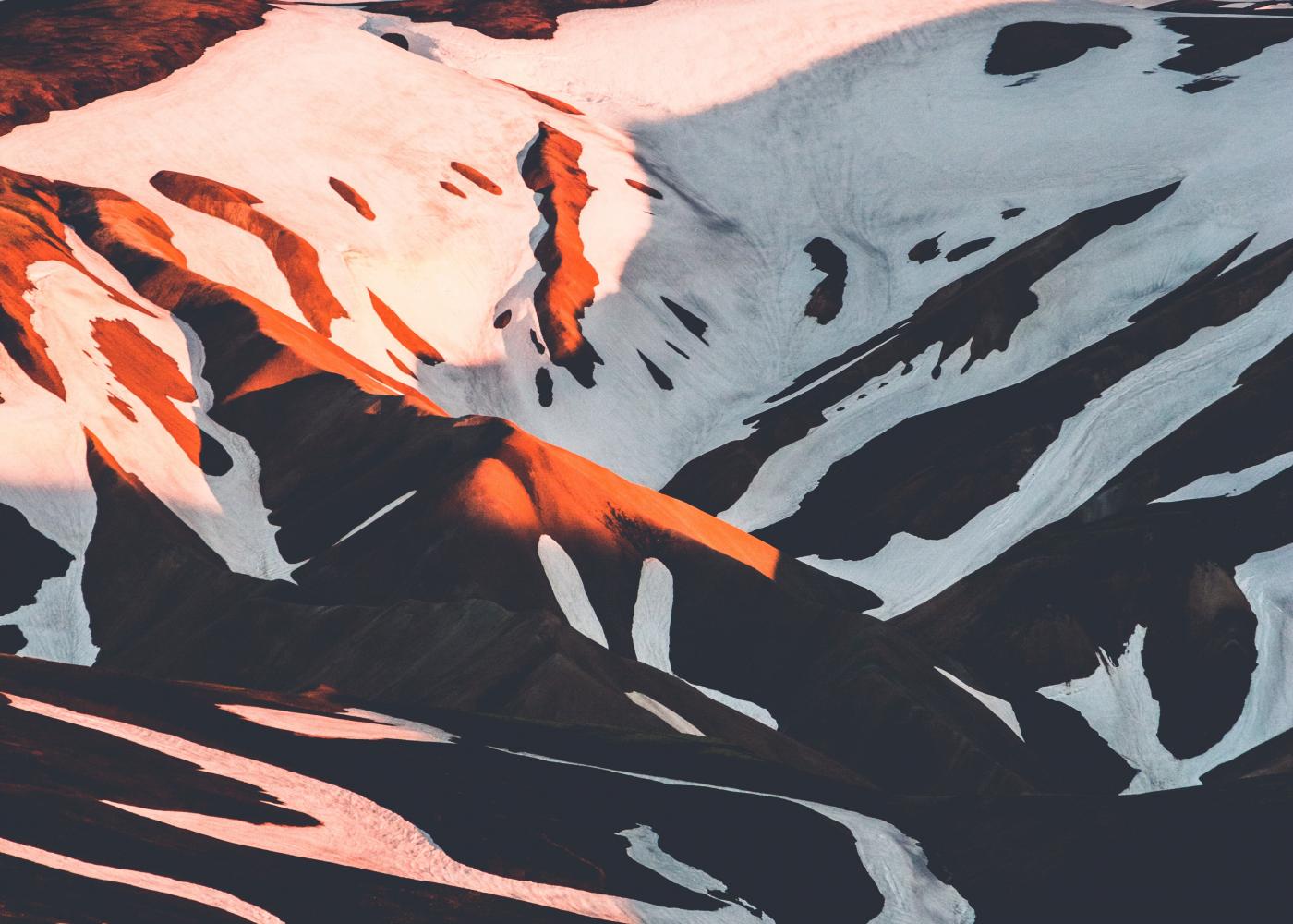
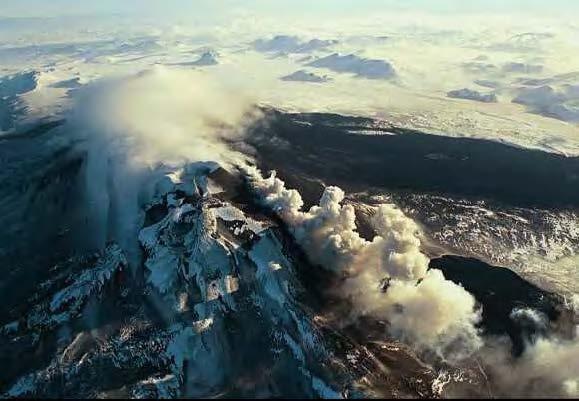
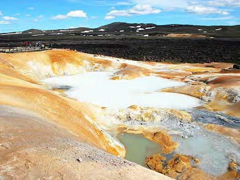
Features that seem to differentiate this “lakes country” of 10,000 years ago and the contemporary desert southwest from almost anywhere else are the young volcanoes and nearby hot springs. Most of the Coso Range rock art is concentrated in the 4.0-2.5 Ma basaltic andesite flows just east of the <1.0 Ma Coso volcanic field (Figures 2 and 3). Some archeologists argue that this rock art was the product of shamans who acted as spiritual leaders of their people.  Others suggest that the rock art may have played a more functional role because of the abundance of hunting images including dietary staples like antelope and sheep.

Regardless, the ground was important if not sacred to these aboriginals.  They remain an integral part of contemporary religious and spiritual practices among tribes of the region.

Image
Looking east over a Coso geothermal field pipeline to dark brown, faulted and incised lava flows.
Caption
Figure 2. Looking east over a Coso geothermal field pipeline to dark brown, faulted and incised lava flows. Most Coso Range petroglyphs are in these flows.

Thousands of years after these rock artists departed, the Navy identified this region as an ideal place to test weapons and established the China Lake military base in 1943. Hundreds of thousands of acres of mostly unpopulated rangeland in a desert that experiences clear skies year-round was ideal for their purposes.  By the early 1970s, after a decade of working at the China Lake as a shape charge expert, Dr. Carl Austin enticed the Navy to enter into a contract with a private company to develop what Austin speculated was a large geothermal reservoir situated within the Coso volcanic field.  It is speculated that these landforms and associated features attracted these first people well over 10,000 years earlier.  They continue to attract us albeit for different reasons.

This relatively unknown and easily bypassed piece of ground in the Mojave Desert has served as a nexus of different civilizations for over ten thousand years. To say that all were drawn by the landscape may not be too far off the mark. Available food and shelter, especially during post-glacial pluvial periods, was also a draw for the earliest civilizations. The vastness of the landscape was an attraction to the military but they had little use for the volcanic field and associated features until its potential, energy-producing value was pointed out in the 1970s when all Americans, including most politicians, knew that clean, renewable energy and energy independence were worthwhile pursuits. Decades later, many current American politicians no longer know this.

Image
Rock art of the Coso Range
Caption
Figure 3. Rock art of the Coso Range (from Garfinkle, 2014; https://ancientamerica.com/paradigm-shifts-rock-art-studies-and-the-coso-sheep-cult-of-eastern-california/.

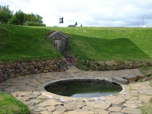
Civilizations often discount if not purposefully destroy traces of prior civilizations. Fortunately, this is not the case in the Coso Range. The rock art of the Coso Range is well known among local Native Americans and archeological communities.  But this work, much like the obscurity of the Coso Range along CA Rte. 395, is little known elsewhere. As it turns out, the Navy base at China Lake is off-limits to visitors. Consequently, much of the culturally-rich ground within the Coso Range, especially in and around the Coso volcanic field, remains untouched and has therefore been preserved since at least 1940s when the base was created. While some may not care for the existence of large military bases, an ironic aspect of their presence is that the land they maintain is cleaner and better preserved than most other public and private lands in the western U.S. outside of State and National Parks.  They maintain a minimal footprint and do what is necessary to clean up after themselves. Similarly, while production from the geothermal field has modified fluid levels and pressures within this active hydrothermal system, the heat source, the fracture networks and the surface hydrothermal manifestations still exist and will be there long after the military and any geothermal operations have moved on. Local tribes are the only people still allowed into the sacred Coso Hot Springs which they visit periodically for spiritual and religious practices.

Do civilizations that occupied the same obscure piece of ground have anything else in common? Would a comparison of these civilization be instructive or offer any value? These indigenous peoples carved rock art with rudimentary tools.  We can access all human knowledge on a phone.  They thrived for thousands of years and were governed by shamans.  Many leaders of our highly educated, post-WWII civilization are putting all living matter on the planet in grave danger today by ignoring science (and logic and reason and…) to put a few dollars in their pockets. Maybe civilization is not the best term for one of these groups. 

We know little about these ancient cultures, how they interacted and treated one another, and even whether or not they were bellicose and waged war. But we do know such things about ourselves.  A deeper inspection of past civilizations may not teach us how to thrive in and honor the same place for 10,000 years.  But it may help us make it to tomorrow.  That would be a big step. There is much to learn.

Authors
Andrew Sabin

Our New Website & A Bright Geothermal Future

Submitted by taotiadmin on Feb 16, 2021
  • Read more about Our New Website & A Bright Geothermal Future
Date
Feb 16, 2021
Regional Overviews
Image
A mountainous region with multiple peaks and valleys, lush greenery, and blue skies

Welcome to the new Geothermal Rising website!

Over the last year, we have worked tirelessly with our partners at Taoti Creative to retire the old Geothermal Resources Council brand, create and launch our beautiful new brand, and are now excited to present the revamped website.

Quote
I don’t think it takes a creative genius to see the differences between our old website and this beautiful new one, but we are also extremely excited about the capabilities and attention to detail that will make this platform one that will springboard Geothermal Rising and geothermal energy into a new era.
Attribution
Will Pettitt, Executive Director

This is the first iteration in the evolution of our digital experience, and we can’t wait to continue to refine and add to it, but here are some of the most exciting pieces of our new site:

  • A complete redesign – how pretty is this thing?!?
  • A more consumer friendly focus that lightly educates on the importance of geothermal energy
  • Renewed focus on the effect and impact that geothermal energy has and can have on the world – we are using the earth to save the earth!
  • Searchable, filterable blog, resources, and events listings
  • A more flexible Content Management System (CMS) that allows us to update the website frequently and keep up with the pace of today’s digital world
  • Search Engine Optimization (SEO) improvements to make sure that Geothermal Rising is one of the preeminent resources on geothermal energy
  • And so much more!

Launched in coordination with our new Members’ website, this new digital face for Geothermal Rising will serve as the central digital platform for our mission to use the earth to save the earth. We appreciate all of the dedicated professionals who made this update possible and look forward to hearing from our members and the general public on what you think!

For any comments, questions, or concerns about the new site please use our Contact Us form and we will get back to you as quickly as possible.

We are pleased to introduce the new Geothermal Rising website, ushering in a bright new future for our organization and geothermal energy.

The Vikings & Geothermal Iceland

Submitted by bschmidt on Jan 28, 2021
  • Read more about The Vikings & Geothermal Iceland
Date
Jan 31, 2020
Regional Overviews
Download PDF
Image
Snow covered mountain in golden hour light

Did the Vikings ever imagine so much heat lay beneath the snow and ice around them—although the climate was a bit warmer back then? Probably not, but why should they? Most of them hailed from Norway, a country with geological stability; a land of ancient metamorphic and sedimentary rocks; and one with no signs of heat but for a tiny spot in the far north and another on the ocean floor. Sure, earthquakes rumbled through occasionally and a few warm springs bubbled in that Arctic archipelago, but the pools of water in the quiet Norwegian woods were cold, and the forested mountains didn’t spew vast clouds of steam, ash, and rock high into the sky; turn snow and glaciers into roaring rivers; or extrude flowing, fiery ropes and sheets of immolating lava. The Norwegian mountains were tree-covered and still; they weren’t volcanoes.

Beginning around 863 A.D., or a bit earlier, Viking ships, many from Norway, began making short Icelandic stopovers. The trip from Norway took about four days in good weather.

In about 871 A.D., a large volcanic eruption dusted most of Iceland in a thin layer of volcanic debris, today called the Landnám tephra. (Tephra is a mixture of fragmented, volcanic products, like ash and cinder.) The tephra layer helps to date Icelandic settlements around the island, for no indications of Viking life have ever been found beneath this layer—except for one grain of barley pollen near the capital city, Reyjavík.(2)

Image
Map of Iceland
Caption
Map of Iceland with the geothermal localities mentioned in the text.

The Icelandic Age of Settlement dates from 874 to 930 A.D., a time of great change. In 874 the first group of Viking farmers moved permanently to Iceland. They came from Norway, and their leader, Ingólfur Arnarson and his wife Hallveig Fróðadóttir, brought along family members, farmhands, and seasick sheep and cattle. On reaching the shore, they climbed freezing from the cargo ship, called a knarr, to begin their new lives.

Image
The knarr is a type of Norse merchant ship the Vikings built for long Atlantic voyages.
Caption
Ingólfur Arnarson most likely used a knarr, shown here, for his trip to Iceland. The knarr is a type of Norse merchant ship the Vikings built for long Atlantic voyages. In fact, Knerrir (the still-used plural of knarr from Old Norse) routinely crossed the North Atlantic delivering livestock, like sheep and horses, and other items to the Norse settlers in Iceland. The model is on display at the Hedeby Viking Museum in Germany. Caption and photo from Modell Knoor, Wikimedia Commons
Image
Ice off the shore of Iceland.
Caption
Was this what Ingólfur Arnarson saw when he arrived in Iceland? Courtesy of Promote Iceland

As they stepped on Icelandic soil, they were standing not only on an island with nine active volcanoes, but one with five of the volcanoes close by, arrayed along the southern coastline. From 874 to 930, the Vikings would build many settlements among the five volcanoes—including Ingólfur and his family, who settled down in a place he called Reykjavík.

Ingólfur chose Reykjavík for his home in an unusual way. Before landing in Iceland, but with land firmly in sight, he tossed his pair of carved, sacred, high-seat pillars overboard—vowing to settle wherever they washed ashore. According to legend, after three years of searching he found the pillars at the edge of a bay he named Reykjavík (“smoky bay”, from the Old Norse) for the active hot springs and fumaroles around it.(4) Eventually many other Icelandic sites were given geothermal names, as well.

Image
Ingólfur Arnarson commands his men to erect his high-seat pillars in present-day Reykjavík. The painting, by Johan Peter Raadsig, was a gift to the City of Reykjavík from the Eimskipafelag Islands. From“Ingólfur by Raadsig,”Wikimedia Commons
Caption
Ingólfur Arnarson commands his men to erect his high-seat pillars in present-day Reykjavík. The painting, by Johan Peter Raadsig, was a gift to the City of Reykjavík from the Eimskipafelag Islands. From“Ingólfur by Raadsig,”Wikimedia Commons

It turns out the Vikings weren’t the first to settle in Iceland. Christianity arrived before them, brought to the island by hermitic Irish monks who lived in caves—possibly inside the lava tubes. Commenting on the long Icelandic days and short midsummer nights, a monk once wrote, “... whatever task a man wishes to perform, even to picking the lice from his shirt, he can manage as precisely as in broad daylight.”(4) When the Vikings arrived, the monks fled in a hurry, leaving behind many personal effects in the rush to get away.

Image
Stöng, a reconstructed Viking longhouse in the Tjórsádalur Valley, east of Laugarvatn.
Caption
Stöng, a reconstructed Viking longhouse in the Tjórsádalur Valley, east of Laugarvatn. Such longhouses were the farm centers for Viking chieftains in the Middle Ages and were used to store food. This replica was rebuilt as closely as possible to the original longhouse specifications. You can see portions of the basic wooden frame, a stone base, and the turf walls and roof. The original building was buried in volcanic ash during an eruption of Mount Hekla in 1104. The site is open to the public. Courtesy of The Commonwealth Farm, www.thjodveldisbaer.is

Mount Hekla, one of the five southernmost coastline volcanoes—and still very active, has erupted well over 20 times since 874 A.D. During the fiery eruption of 1104, huge blankets of tephra destroyed at least 20 farms in southern Iceland. One such farm, named Stöng, has been excavated, rebuilt, and opened to the public. The farmstead is preserved perfectly, like an Icelandic Pompeii. The sod walls were left nearly intact beneath the thick layers of tephra.(4)

Image
Enlarged view of an eruption at Mount Hekla, drawn in 1585. The Latin inscription reads: Hekla perpetuis damnata estib. et ni uib. horrendo boatu lapides evomit. In English: Hekla, forever condemned to storms and snow, vomits stones with a horrible noise.
Caption
Enlarged view of an eruption at Mount Hekla, drawn in 1585. The Latin inscription reads: Hekla perpetuis damnata estib. et ni uib. horrendo boatu lapides evomit. In English: Hekla, forever condemned to storms and snow, vomits stones with a horrible noise. (Note: the Latin word, ni, should be spelled nix, meaning snow.) Translation by L. Donovan. Map courtesy of the Osher Map Library, University of Southern Maine (oshermaps.org/map/7348.0224)

Inspired by the 1104 eruption, monks began spreading tales throughout Europe that Mount Hekla was a gateway to Hell. This speculation is illustrated dramatically in books and maps from The Middle Ages—as you can see on the 1585 map of Iceland reprinted above. Notice how Mount Hekla, the largest feature on the map and one covered in flame, spews dark smoke and volcanic bombs—the arc of black dots above the smoke.

Image
Mount Hekla volcano, erupting in 2000. Photo by Sigurjón Sindrason; reproduced courtesy of Dr. Sindrason and the Icelandic Institute of Earth Sciences.
Caption
Mount Hekla volcano, erupting in 2000. Photo by Sigurjón Sindrason; reproduced courtesy of Dr. Sindrason and the Icelandic Institute of Earth Sciences.

Dr. Sindrason worked for the Nordic Volcanological Institute from 1975 to 1984. During that time, he and others studied Krafla, a volcano mentioned in the hot springs photo caption.

When I asked Dr. Sindrason about his Viking ancestry, he said it was “a bit too long ago.” He thought I had meant family stories from the last several hundred years, but I’d really wanted him to go back 1,000 years or more. Impossible because he was right; the events were “a bit too long ago.”

Image
View of Mount Hekla covered in snow. From Hekla and gate, Wikimedia Commons
Caption
View of Mount Hekla covered in snow. From Hekla and gate, Wikimedia Commons

Back in 930, 201 years before the 1104 eruption of Mount Hekla, the first Icelandic national assembly, called the Althing, met at Thingvellir (“Parliament Plains”) about 50 km from Reykjavík. Today Thingvellir is a National Park and an UNESCO World Heritage Site. Its long and incredible expanses of lava form part of the mid-Atlantic ridge.

The Vikings created the Althing to establish a common code of law suitable for a republic (not a monarchy) and to settle disputes. Here was where the Law-Speaker spoke to the assembled Vikings in front of the great wall of lava. “The riven wall of lava made a splendid sounding-board for speakers’ voices in those days before microphones and amplifiers were invented.”(4)

Image
Thingvellir National Park, since 2004 an UNESCO World Heritage Site. From Thingvellir aerial panorama, Wikimedia Commons
Caption
Thingvellir National Park, since 2004 an UNESCO World Heritage Site. The distant, dark horizontal lines are extruded basalt walls. The Althing, a small, block-filled cleft in a wall, may be just right of where water spills though the lower wall on the photo upper right. The Althing itself is depicted below in the 19th century painting by Collingwood. From Thingvellir aerial panorama, Wikimedia Commons

By the year 1000, just 70 years later, the King of Norway was pressuring Iceland to renounce paganism and accept Christianity. Icelandic political opinion on the matter was polarized into two bitterly opposed factions. War seemed imminent. Sensing a crossroad, the leader of the Christian party, Hall of Siða, asked the Law- Speaker of the Althing, a pagan named Thorgeir Thorkelsson, to arbitrate. Everyone swore to follow his decision.

After considering the situation for a day and night, and in the interests of peace, Law-Speaker Thorkelsson declared that all unbaptized people in Iceland should become Christians and be baptized—meaning they would be submerged in cold water. Now real trouble arose. The Icelanders agreed to become Christians only if hot water was used in the ceremony.

And so it was. People from northern and southern Iceland were baptized in a hot spring named Reykjalaug (later called Vígðalaug, “the consecrated spring”) at Laugarvatn. Those from western Iceland were baptized in a hot spring named Lundarreykjadalur (later called Krosslaug, “the spring of the cross”) at Reykjalaug. Since then, both of these hot springs are said to hold healing powers.(3)

Image
The Althing in Session. The oil painting is by W. G. Collingwood. From Law-Speaker, Wikimedia Commons
Caption
The Althing in Session. The center of attention at an Althing gathering was the large, basaltic law rock at the top of the cleft filled with boulders. Here is where the presiding official, the Law-Speaker, addressed the assembly. In the painting he is clothed in green and speaking from the far edge of the law rock. The oil painting is by W. G. Collingwood. From Law-Speaker, Wikimedia Commons

Iceland lost its independence to the King of Norway in 1262 and together with Norway to the Queen of Denmark in 1388. Toward the end of the thirteenth century, the Norwegian Archbishop of what today is Trondheim apparently won exclusive rights to buy and transport native sulfur from Iceland. The sulfur was collected from locations known today to include high-temperature geothermal fields. Exactly what the sulfur was used for is unclear, as gun powder hadn’t yet been invented.(3) Some say the Catholic Church may have exported the sulfur to European churches so the congregations could grow familiar with the odor of hell.1 Icelandic sulfur rights—sometimes quite valuable—were controlled by the Danish King for many years until the rights were returned to Iceland in the 1760s.(3)

Image
Native sulfur covers the sides of an Icelandic volcano. Courtesy of Promote Iceland
Caption
Native sulfur covers the sides of an Icelandic volcano. Courtesy of Promote Iceland

How many hot springs are in Iceland? The count includes 250 thermal areas and 600 major hot springs. Surprisingly, geothermal expert Ingvar Fridleifsson finds no correlation between natural hot spring locations and the sites where early Vikings chose to build the farmhouses. Even the first settler, Ingólfur Arnarson, built his own farmhouses about 3.5 km away from the nearest hot spring, apparently preferring a good landing beach for his boats to the luxury of nearby hot waters for things like bathing, laundry, and cooking—not his duties, after all.(3) Several years ago, parts of his farmhouse were discovered under the southern end of Reykjavík’s Aðalstraeti (“Main Street”) that runs down to the harbor.(4)

In the eighteenth century, hot springs were considered “nuisances” by some farmers who were quoted in a book titled, Description of the Farmsteads of Iceland, 1703-1714. One farmer said, “A part of the hay field is spoiled by a hot secretion caused by a nearby hot spring.” Another complained, “Storms are fierce so that both houses and haystacks are in danger. The water is warm (read ‘undrinkable’).”(3)

Image
The hot springs at Leirhnjukur date from an eruption through a fissure in the mid-1970s. Note the abundant patches of native sulfur on the surrounding rocks. The hot springs, photographed in 2008, are about 2 kilometers from the Kafla power plant. During the eruption, a string of lava was produced from a geothermal well nearby. Photo and information by Ronald DiPippo
Caption
The hot springs at Leirhnjukur date from an eruption through a fissure in the mid-1970s. Note the abundant patches of native sulfur on the surrounding rocks. The hot springs, photographed in 2008, are about 2 kilometers from the Kafla power plant. During the eruption, a string of lava was produced from a geothermal well nearby. Photo and information by Ronald DiPippo

Only one pre-twentieth century archaeological structure exists where hot spring waters may have been used for space-heating. This is in the farmhouse (barely seen in the photo) built behind a hot water pool called, Snorralaug (“Snorri’s bath”), in the village of Reykholt. Snorralaug itself is the only ancient (probably 13th century), man-made bathing structure still standing in Iceland, and it resembles a 4 meter wide, stone-sided, backyard hot tub.

Built by powerful chieftain, famed historian, and writer of sagas, Snorri Sturluson (1178-1241), Snorralaug was heated with steam and hot waters flowing through two conduits from a nearby hot spring, called Skrifla. A third conduit from the hot spring bypassed Snorralaug entirely and went straight to the farmhouse in back. Were at least some farmhouse rooms warmed by geothermal heat? Perhaps, yes.

Image
In 13th century Iceland, Snorri Sturluson built a farmhouse and this heated pool, called Snorralaug. The site was restored in 1858 and 1959. A tunnel dug behind the door allowed Snorri to move quickly from the pool to his farmhouse. The outdoor pool and perhaps the farmhouse were heated by steam and hot water flowing through conduits from a nearby hot spring. The hot water enters the pool from the ditch on the right. Photo from Snorralaug, Wikimedia Commons
Caption
In 13th century Iceland, Snorri Sturluson built a farmhouse and this heated pool, called Snorralaug. The site was restored in 1858 and 1959. A tunnel dug behind the door allowed Snorri to move quickly from the pool to his farmhouse. The outdoor pool and perhaps the farmhouse were heated by steam and hot water flowing through conduits from a nearby hot spring. The hot water enters the pool from the ditch on the right. Photo from Snorralaug, Wikimedia Commons

We do know that for over a millennium, thousands of Icelanders living in a very cold climate never used the nearby hot waters to warm their houses. In 1908, perhaps the first person to do so was a farmer at Reykir in Mosfellssveit, Stefán B. Jónsson (1861-1928). He brought hot spring waters through a 2.3 km pipeline into his home to heat the radiators. Not long after, in 1911, Erlendur Gunnarsson, from Sturlureykir in Western Iceland near Reykholt, invented a simple mechanism to separate the steam from the hot water in a boiling spring next to his house. He used the steam for cooking and heating.(3) The two installations, invented over a century ago, began the modern era of geothermal development in Iceland.

Selected References
  1. Björnsson, L., 1994, Personal communication, from Fridleifsson, Ingvar Birgir, 1999, Historical Aspects of Geothermal Utilization in Iceland, in “Stories from a Heated Earth,” Cataldi, Raffaele, Hodgson, Susan F., and Lund, John W., eds., published by the Geothermal Resources Council and the International Geothermal Association, Davis, California.
  2. Fitzhugh, William W. and Ward, Elizabeth I., 2000, Vikings, the North Atlantic Saga, published by the Smithsonian Institution Press, in association with the National Museum of Natural History, Washington, D.C.
  3. Fridleifsson, Ingvar Birgir, 1999, Historical Aspects of Geothermal Utilization in Iceland, in “Stories from a Heated Earth,” Cataldi, Raffaele, Hodgson, Susan F., and Lund John W., eds., supra.
  4. Magnusson, Magnus, 1980, VIKINGS!, published by E.P. Dutton, New York.
Acknowledgments

Thanks to Brian Billings for helping with the Latin translation, and to Dr. Sigurjón Sindrason for kindly answering my questions.

Why and when did the Vikings come to Iceland—the land of fumaroles, geysers, thermal waters, and volcanic eruptions? And what happened next? It’s quite a story.
Authors
Susan Fox Hodgson

Sprinkled Like Paprika, The Thermal Waters of Hungary

Submitted by bschmidt on Jan 21, 2021
  • Read more about Sprinkled Like Paprika, The Thermal Waters of Hungary
Date
Jun 01, 2020
Regional Overviews
Download PDF
Image
Pre-Cenozoic geological map of Hungary
Quote
The essence of everything is that it is very complicated.
Attribution
Prof. Dr. Judit Mádl-Szőnyi, Geologist, Eőtvős Loránd University, Budapest
Just Steps Away

The moment of truth had come. On my first day in Budapest, armed with a metro pass and two clues, I set off to find the office of Porció Ltd., the geothermal company of Gábor Szita, who had kindly helped to arrange my Hungarian visit and geothermal appointments. (Note: In Hungary, a person’s last name, like Szita, is written before the first name. However, first names will be placed first in this article.) Back home in California, I’d found the location of Gábor’s office impossible to pinpoint — elusive, like some geothermal resources.

The journey took over an hour. But after a metro ride under Pest (clue one), a trolley ride through the woodsy Buda hills (clue two), a short walk going the wrong way and another one retracing my steps (clueless), I found the street sign and then his office, two buildings away and up a short hill. My 6,300-mile trip spanning a continent- and-a-half, plus an ocean, was over. It was time to learn about the thermal waters of Hungary.

Image
View of the Cities of Buda and Pest (today Budapest), as seen in Ottoman times; after a painting by Joris Hoefnagel published in 1617
Caption
About this Image: View of the Cities of Buda and Pest (today Budapest), as seen in Ottoman times; after a painting by Joris Hoefnagel published in 1617. Hoefnagel’s name and the date 1657 are included on this copy of the painting, printed 40 years later.
In the distance and across the Danube River is the City of Buda, with a hilltop fortress and the royal palace. The City of Pest, strongly fortified, is on the opposite bank in the lower-left corner. A pontoon bridge links the two cities.
The City of Buda was the seat of the local Pasha, standing in the foreground on the Pest side by his delija (“bodyguard”). The bodyguard wears feathers pierced through the skin of his scalp. Information courtesy of Altea Antique Maps, London; Photo by S. Hodgson, taken in a Hungarian restaurant on the Buda side.
Pannonian Basin, The Source

The Pannonian Basin once held the huge and shallow Pannonian Sea. The sea covered parts of modern-day Hungary, Slovakia, Poland, Ukraine, Romania, Serbia, Croatia, Slovenia, and Austria. Three to four kilometers of sediments were deposited in the sea when it was at its largest, 5.3 to 2.6 million years ago in the Pliocene Epoch.

Most of the sandy sediments were deposited along the borders of the sea. Today these sediments hold the most significant thermal-water reservoirs in Hungary.(1)

The second major source of Hungarian thermal waters is the limestone strata under the Pannonian Sea, formed from the calcified remains of aquatic organisms. Limestone itself often has little innate porosity, but it is often dissolved by groundwater. Eventually, as happens in Hungary, enlarged fissures form, leading to the development of caves and well-defined underground water courses—typical karst features.(2)

About 80 percent of Hungarian thermal wells extract water from porous late Pannonian sandstone layers, and 20 percent from fragmented carbonate rock (karst) formations.(3)(4)

But how is all this water heated? The answer lies far beneath the Pannonian Basin. Here, a portion of the earth’s crust has been stretched so thinly that heat rising from below infiltrates the basin sediments.(5) “Because of this, the entire basin is characterized by an elevated heat flux (~100 mW/m2) compared to the surrounding regions.” (6)(7)( 8)

Image
Porous (sedimentary) and karst thermal-water reservoirs in Hungary.
Caption
Porous (sedimentary) and karst thermal-water reservoirs in Hungary.(9) Reprinted with permission

In summary, about two-thirds of the Hungarian national territory is underlain by vast thermal reservoirs in sandstone sediments and karst formations. Today much of the surface is covered by rolling plains; only one hill rises above 1015m.

The map at the beginning of the article illustrates the Pre-Cenezoic surface of Hungary. Besides the highly complicated geology, the relief at the surface is highly pronounced.

Thermal Bathing History

Through time, the Hungarian people have experienced changes under several rulers — including the Ottomans. But who was the first person ever to bathe in Hungarian thermal waters, and when? No one knows.

The oldest Hungarian archaeological site with evidence of (human?) presence, called Vértesszőlős, is found near a warm spring! Discovered in the 1960s, the site is near Tata (see Map 1). The site was occupied about five times between about 500,000 and 250,000 years ago. The first known traces are of Homo heidelbergensis. Whether these beings are ancestral to humans or not hasn’t been decided.

Image
Near a warm spring, fragments were found of an occipital bone from Homo heidelbergensis.
Caption
Near a warm spring, fragments were found of an occipital bone from Homo heidelbergensis. Courtesy of Wikipedia

Thousands of centuries later, thermal bathing played a huge role in Roman life, long before the Romans ruled present-day Hungary. When they came, they brought along their bathing customs — as we know from the many elaborate bath houses built by the Romans at Aquincum — an important Roman city in northern Budapest on the western bank of the Danube.

The waters at Aquincum were cool, but the Romans used hotter waters whenever possible. In fact, the army used thermal waters to care for the horses. Whenever possible after rigorous days on the move, the soldiers led their horses into nearby pools of thermal water to relax and heal.

Dates differ for the years of Roman rule, which probably began between 35 to 9 BC and ended around 409 AD. The Hungarians came later, occupying the Pannonian Basin at the end of the ninth century. Some evidence exists of Hungarians using thermal baths during the Hungarian Kingdom period, between 1000 and 1526 AD —the year the Ottomans conquered Hungary. The Ottomans left Hungary in 1699. They often built Turkish baths near hot springs, and some have been enjoyed from that day to the present.

Thermal Bathing Facts and Figures

Over the entire Pannonian Basin, a thermal borehole is found almost every 10 km.(10) In 2019 in Hungary, over 900 active thermal water wells produced about 90 million m3 of thermal water, representing 1023.7 MWt or 10,701 TJ/y.(9) The waters were extracted mainly for bathing and wellness. (for more information, contact Prof. Dr. Rybach at: rybach@ig.erdw.ethz.ch10 or Prof. Dr. Tóth at: toth.aniko@uni-midkolv.hu).(9)

Historically, balneology is the country’s most important geothermal application, with over 250 wells yielding thermal and (sometimes) medicinal waters. These represent a total installed capacity of 249.5 MWt, with an annual use of about 3684 TJ/yr.(9)

Prof. Dr. Tóth wrote, “Most thermal wells in Hungary (40 percent of about 600 wells) are used as spas, their temperature values fall within the 30°-50°C range, and they extract water from the porous Miocene layers found 500-1500 m below the surface. Waters with temperatures above 60°C are recovered from the fissured karst reservoirs in the basement rock. Such wells are found, for example, in Zalakaros (about two hours southwest of Budapest), where the water temperature is 99°C, and in Gyula (see Map 1), where it is 91°C.”(1)

Knowing which minerals are dissolved in the thermal waters is important to many spa patrons who come for their health. The minerals dissolved in Hungarian thermal waters include simple carbonated water, earthy-limey water, alkaline water, chloride water and sodium chloride water, sulfurous water, iodine-bromine water, and radioactive water.(1) Many thermal baths offer bottled thermal waters for sale.

Image
The label on a bottle of mineral water from the Csillaghegyi Baths and Swimming Pool in northern Budapest
Caption
The label on a bottle of mineral water from the Csillaghegyi Baths and Swimming Pool in northern Budapest, on the Buda side. Photo by S. Hodgson
Image
The map illustrates the numbers and locations of thermal baths in Hungary
Caption
The map illustrates the numbers and locations of thermal baths in Hungary. The green dots denote the significant baths and the red dots, the baths of local and regional importance.(1) The place names themselves are too small to read. Reprinted with permission
Image
Map of Thermal Waters in Hungary
Caption
Map 1: Just north of Budapest, the course of the Danube River suddenly turns south. As it flows through Budapest, the river passes several thermal baths on the western river bank, on the Buda side — and a few thermal baths built further inland on the eastern side, in Pest. The baths in Pest are fed by thermal waters from deep wells, not hot springs. Map courtesy of the CIA, with added cities
Bathing in Budapest

The Budapest area, famous for its thermal springs and spas and outstanding thermal water resources, is one of the main discharge regions of the largest, karstified, carbonate- aquifer system in Hungary. Here, from the second half of the 19th century on, the use of natural springs has been substituted progressively by deep wells. This is because thermal water — from the region where carbonate formations are confined by low-permeability layers of any regional flow system — can be used for geothermal purposes by deep wells.(8)

The springs and wells that supply the famous baths of Budapest discharge mainly from a regional Triassic carbonate rock aquifer system (with karst features). The springs mostly have been replaced by wells. Only a few natural springs are known today; most drain unused into the Danube.(11)

Budapest has 11 major thermal baths, many using thermal water from shallow and deep wells. Springs arise along the Danube fault trending north-south on the western bank of the Danube River — on the Buda side. Calcified caves are found close to the discharge areas of the springs.

The four major baths on the Buda side, from south to north, are St. Gellért, Rudas, Király, and St. Lukács.12 All were built in the Danube fault zone and use thermal waters from shallow wells connected to the fault zone. Water temperatures in the fault zone are hottest to the south and cooler the further north you go. Thus, the southernmost thermal bath of the group, St. Gellért Thermal Baths and Swimming Pool, has the hottest thermal waters.

In 1918, St. Gellért Thermal Baths and Swimming Pool opened its doors. The famous building is beautifully decorated in the Sucessionist, Art Nouveau style — including original, pyro-granitic ornamentation from the famous Zsolnay factory. In the Middle Ages, a hospital stood here.

Image
An advertisement by the St. Gellért Baths features the famous pool.
Caption
An advertisement by the St. Gellért Baths features the famous pool. Photo by S. Hodgson
Image
Entrance hall to the St. Gellért Baths.
Caption
Entrance hall to the St. Gellért Baths. Photo by Thaler Tamas, courtesy of Wikipedia
Image
Original, pyro-granitic floor designs and tiles from the Zsolnay factory..
Caption
The original, pyro-granitic floor designs and tiles are from the Zsolnay factory. At one time, only men used the pool. Now women come to bathe as well. Photo by S. Hodgson

Eszter Pulay, an Environmental Scientist, led me on a tour through St. Gellért’s rooms and pools. When we finished, we walked north through a tunnel to the spa next door, the Rudas Thermal Baths and Swimming Pool. The tunnel includes observation wells and is used for finding new wells and sources of thermal waters.

Presently, three wells are being used by the St. Gellért Bath and one or two by the Rudas Baths. “The thermal wells, drilled into karst features, are older than the bath buildings themselves,” said Andrea Ligeti, our guide at the Rudas Baths. “The thermal waters were used before construction began.” (For more information, contact Ms. Pulay at: pulay.eszter@spabudapest.hu).

Mustafa Pasha built the Rudas Baths during the Ottoman occupation of Hungary in the 16th century. The building has been expanded through the years, and the last renovation ended in 2005. All this time, the original, historical area has remained untouched— including the dome (10 meters in diameter), supported by eight pillars around a lovely, octagonal pool. A drawing hangs nearby of Ottoman bathers using the pool.

Image
Street entrance to the Rudas Thermal Baths and Swimming Pool...and Bistro. The building faces the Danube River.
Caption
Street entrance to the Rudas Thermal Baths and Swimming Pool...and Bistro. The building faces the Danube River. Photo by S. Hodgson
Image
Drawing of the Rudas Baths in Ottoman times, by Rohbock in 1859. n
Caption
A skillful drawing of the Rudas Baths in Ottoman times, by Rohbock in 1859. Visitors bathe in thermal waters filling the large pool under the original dome in the historical area. Photo by S. Hodgson
Image
View from the upper terrace of the Rudas Baths
Caption
From the upper terrace of the Rudas Baths, guests can enjoy relaxing views of the Danube River flowing by. Photo by S. Hodgson
Image
A list of the dissolved minerals in the drinking fountain waters at the Rudas Baths
Caption
A list of the dissolved minerals in the drinking fountain waters at the Rudas Baths — and medical comments. Photo by S. Hodgson
Image
A store with “medicinal drinking water” for sale at the Rudas Baths.
Caption
A store with “medicinal drinking water” for sale at the Rudas Baths. Photo by S. Hodgson

Eszter Pulay works at the Király Thermal Baths, located just north of the Rudas Baths. Construction was begun here in 1565 by Arslan, the Turkish Pasha of Buda, and was completed by his successor, Sokoli Mustafa. The Király never has had its own supply of thermal waters. The Ottomans built Király too far away from the thermal wells for this — on purpose. They made sure the thermal baths would be available to them inside the fortress walls during sieges.

At first, redwood pipes were used to channel the waters to Király from what is now called the St. Lukács Thermal Baths and Swimming Pools (just to the north). Today, Király still uses the same thermal waters drawn from the same St. Lukács’ wells.(12)

Image
The Király Baths in Budapest
Caption
The Király Baths, pictured here, and the Rudas Baths are two of the four original Turkish baths still open in Budapest. Courtesy of Wikipedia

St. Lukács Thermal Baths and Swimming Pools has a recorded history dating back to the 12th century, when the St. John Knights came to cure the sick. Knights from the orders of Rhodes and Malta followed and built monastery baths.

In the Middle Ages, St. Lukács Baths was the favorite of the Turkish Grand Vizier, Pasha Mustafa. When the City of Buda was recaptured from the Ottomans in 1686, St. Lukács became property of the Treasury. In 1884 Fülöp Palotay purchased the property from the Treasury and began what would become 121 years of remodeling.

Image
Entrance to St. Lukács Thermal Baths and Swimming Pools.
Caption
Entrance to St. Lukács Thermal Baths and Swimming Pools. Photo by S. Hodgson
Image
An outdoor swimming pool at St. Lukács.
Caption
An outdoor swimming pool at St. Lukács. Swimmers in the outer circle are moving against a strong current. Photo by S. Hodgson

“On the Buda side of the Danube River, the carbonate formations with karst features are close to the surface, (as the four thermal baths illustrate),” said Prof. Dr. Mádl-Szőnyi.(8) “On the Pest side, the carbonates form deeper strata and a porous cap rock traps the rising heat in the carbonate. This is why the waters on the Pest side are hotter than on the Buda side.(13) On the Pest side, waters for the thermal baths come from deep wells, not hot springs (For more information, contact Prof. Dr. Mádl-Szőnyi at: szjudit@ludens.elte.hu).

The Széchenyi Thermal Baths and Swimming Pools is the best known thermal bath on the Pest side. Széchenyi extracts 74°C and 77°C thermal waters from two wells drilled 1650 m deep into carbonate rocks in the fault zone. Drillers at the Paskál well entered a 300 meter-long vertical shaft, an amazing karst thermal feature.

Széchenyi’s history began in the 1870s when hot spring wells were drilled near a small bathing structure built at Hero’s Square, near the City Park in Budapest. As patronage grew, the bathing structure was rebuilt on an island in the City Park. Finally, in 1909, construction began on what would be the massive, beautiful building admired in the City Park today.

Some recycled thermal waters from Széchenyi are piped to an artificial lake in the City Park. Others help heat two thirds of the city zoo, lowering the gas bill by one half. Heated areas include the animal enclosures, the pools for tropical animals, and the palm house.(1)

Image
An aerial view of the Széchenyi Thermal Baths and Swimming Pools, built in the City Park of Budapest.
Caption
An aerial view of the Széchenyi Thermal Baths and Swimming Pools, built in the City Park of Budapest. Courtesy of Wikipedia
Heating and Electrical Generation

Thermal waters heat many structures in Hungary. In fact, heating greenhouses with thermal waters is the second oldest geothermal application in the country, and very significant. In Hungary, 493 wells produce 11 million m3 of thermal waters used to heat over 70 hectares of greenhouses and 260 hectares of ground-heated polytunnels (tented structures). In the 1960s, Hungary’s oldest and most significant greenhouse network began using thermal waters for heating greenhouses and polytunnels at Árpád Agrár Zrt., in the city of Szentes (see Map 1).(1)

After making a few calls, Gábor Szita spoke with Mr. Sánder Mártin, 91-year-old man who once worked as chief accountant for Árpád — or a prior iteration of the company. Mr. Mártin said a small, state-owned, horticultural research institute in Szentes had used geothermally heated greenhouses a few years before Árpád came. Once Árpád constructed its own greenhouses, it took the lead.

One afternoon Gábor and I drove to Veresegyház, a city of about 20,000 people (see Map 1). Here, thermal waters heat structures built in the city center and on the outskirts. We had appointments to visit a greenhouse and several other buildings that were heated geothermally.

Outside of Veresegyház proper, we passed two large factories run by General Electric — GE Aviation and GE Power — built on eight hectares of land. The plant is heated by a huge geothermal system: three production wells and one injection well, all city-owned. The water temperatures are between 66°C and 72°C. The city has built a double pipeline network, 18 km long, to the site.

We arrived at the greenhouses of Veresi Paradicsom Ltd. on time. This new, innovative, and growing agricultural company was built in Veresegyház at Gábor’s suggestion. The company raises tomatoes in 63,000 m2 of greenhouses heated by geothermal waters piped in from Veresegyház wells. The zero-emissions heating system doesn’t damage the environment; all the waters are cooled, cleaned, and reused.

The company has installed artificial, LED-based, supplementary lighting in the greenhouses — the first in Hungary and maybe the world to do so, according to Tungsram.com. The lighting makes year-round plant growth and sales possible, said Zsolt Márkus, owner and managing director of Veresi.

Company innovations include the tomatoes themselves. Zsolt says Veresi is the first to ever measure the sugar content of tomatoes.

Image
Tomato leaves and flowers. Courtesy of Veresi Paradicsom Ltd.
Caption
Tomato leaves and flowers are culled every day from the plants. Courtesy of Veresi Paradicsom Ltd.

Ripened tomatoes are harvested daily by workers who change their gloves at the end of each row to avoid harming the next one. A bunch of tomatoes is never picked until even the lowest tomato is the right color. Veresi first sold the tomatoes abroad, but today sells about 95 percent of them in Hungary. The company recently received the Innovation Technology Ministerium Award for 2020.

Veresi tomatoes are so well regarded that the chef of Onyx, a two-star restaurant in Budapest, comes to the greenhouses to pick his own. Walking in Budapest the next day, I passed by Onyx. First on the menu — a tomato appetizer (for more information, contact Dr. Márkus at: zsolt.markus@garden-invest.com).

Image
The Onyx restaurant in downtown Budapest.
Caption
The Onyx restaurant in downtown Budapest. Photo by S. Hodgson

Leaving Veresi with small boxes of cherry tomatoes, we drove to the city center and parked at the Veresegyház hospital, which was geothermally heated. Our appointment was with the city mayor, Mr. Bela Pásztor, who was elected to the office in 1965. On sitting down, I asked Mr. Pásztor for the story of geothermal development in his city. He told us proudly, “Today 81 percent of consumers are connected to our geothermal system.”

Image
Bela Pásztor, photo left, talking with Gábor Szita in front of the city hospital.
Caption
Bela Pásztor, photo left, talking with Gábor Szita in front of the city hospital. Photo by S. Hodgson

He recalled when the first geothermal well was drilled in 1987 to a depth of 1500 m, with temperatures reaching 65°C. The well was tested for over a year to ensure the production was stable. Gábor told me the well’s success even surprised the hydrologist — for drilling is a risky undertaking. A third production well was drilled in 2015, and its production exceeds that of Well 1. Well 3, drilled 1700 m deep with temperatures of 71°C to 72°C, has minor scaling. About 1200 to 1700 m is the average drilling depth for wells in this part of Hungary, but wells drilled in the Triassic limestone are known to reach 2000 and 2800 m.

Image
The site of the first geothermal well in Veresegyház.
Caption
The site of the first geothermal well in Veresegyház. Drilled in 1987, it was replaced in 1997 by the well in the building. Péter, standing by the door, cares for the well system. Photo by S. Hodgson
Image
The geothermally heated kindergarten in Veresegyház.
Caption
The geothermally heated kindergarten in Veresegyház. Photo by S. Hodgson

The mayor said the city’s original goal was to build a thermal bath with geothermal waters, but there wasn’t enough money to pay for the building. Then they heard geothermal waters can heat buildings. A geothermal pipeline network was begun in 1993 for transporting thermal waters to the elementary school. Four years later, the piping network was connected to the music school and the culture house.

“Needing more geothermal waters, we drilled new wells,” he said. “All are successful. Currently we are designing a new production well and a new injection well to supply heat to blocks of buildings, each with 10 to 12 small apartments. The city will own some of the apartments; the others will be privately owned. Today we have about 7,000 detached houses and apartments in the city. About 350 of the apartments are heated solely by geothermal waters.”

In 2008, when Hungarian housing prices dropped, Porció Ltd. (Gábor’s company) built 180 to 190 flats — geothermally heated — in Veresegyház. They were finished around 2014 and all were sold. Their values may have risen over 50 percent in the last 10 years.

Image
A row of geothermally heated flats built by Porció Ltd. in Veresegyház.
Caption
A row of geothermally heated flats built by Porció Ltd. in Veresegyház. Photo by S. Hodgson

Talking about the city’s abundant geothermal waters, the mayor said, “We just wanted to use them. Every year our thermal waters replace about 3.5 million cubic meters of natural gas.” When I asked about the risks involved in developing geothermal resources, Mr. Pásztor said, “We have a chance only if we risk.”

Thanking the mayor for his help, we left to see more geothermal projects in Veresegyház. The geothermally heated buildings include the town hall, the post office, the football stadium, and an open-air bath. The municipality determines the price of geothermal energy in Veresegyház, not the state. The local energy source benefits the local community.

Porció Ltd. is a Hungarian company working on geothermal projects. Owned by Gábor Szita, Porció’s business model is to build a geothermal project, operate it successfully, and transfer (sell) it, often to a municipality. If the project doesn’t perform well, a prospective buyer is free to walk away (For more information, contact Dr. Szita at: szitag@mgte.hu).

Another Hungarian geothermal company is NEG Zrt., the National Energy Management Company, whose CEO is István Donázy. NEG Zrt. is controlled by the Hungarian National Asset Management Company, Ltd.

Mr. Donázy said the company’s main goal is to promote energy-conscious operation for its clients, reducing their energy costs. NEG seeks to stimulate, catalyze, and assist legislators with first-hand information, creating a regulatory environment advancing these goals. The company helps the owners of industrial and agricultural infrastructures modernize their energy requirements, increase renewable-energy production, and renovate state and municipal energy use.

The Municipality of Budapest owns the city tram system, where about 600 trams operate every day. The transport company repairs the trams inside a very large building. A current NEG project is to heat the building with geothermal energy instead of natural gas.

To this end, NEG has drilled a geothermal production well and injection well in Budapest. The production well penetrated a hot-water aquifer about 1300 m deep, with waters of about 72°C flowing over 1300 ltr a minute — more than expected. The injection well penetrated a huge karst cavern at a depth of about 1250 m. The thermal waters will be used to heat the tram repair building. These thermal wells are the first ever drilled in Budapest solely for a heating project.

The project began four years ago, and the implementation phase has been underway for two. Originally 6 million kWh of electricity was needed to heat and operate the building each year. The new geothermal heating system will use only 300,000 kWh of electricity every year for operating the pumps and other elements. The geothermal heating system consumes no natural gas and emits no carbon dioxide. (for more information, contact Dr. Donázy at: donazy.istvan@negzrt.hu).

Another Hungarian company, PannErgy, developed Hungary’s largest district heating project in Miskolc (see Map 1). Next the company built the large, direct-use project in Györ (see Map 1). PannErgy also operates two smaller geothermal systems in Szentlőrinc (see Map 1), and Berekfürdő (about two and a half hours east of Budapest). The company recently reported a 20 percent increase in geothermal heat sales for 2019.

Power Plant

Hungary has one geothermal power plant, located in Tura (see Map 1). The electrical production is 2.3 MWe gross and 1.3 MWe net, according to the Mining and Geological Survey of Hungary. This is the first geothermal power plant ever built in the Pannonian Basin.

Governmental Policy

Gábor Szita believes the future of geothermal in Hungary depends on whether the government policy supports geothermal projects, as did the former government 10 years ago when geothermal development flourished. Then monies were available, the plants ran at high efficiency, and all the equipment worked. The government only has to re- implement the plan.

Moving toward this goal is the Division of Business Development and Communication, in the Mining and Geological Survey of Hungary. The division is headed by Dr. Annamária Nádor, who kindly sent the following information about a new plan for geothermal risk insurance.

She writes, “Hungary is well advanced in introducing a new geothermal risk insurance scheme in 2020. This is well established at the policy level: both the new National Energy Strategy and the National Energy and Climate Plan (both issued in January 2020) explicitly mention the Geothermal Guarantee Fund. The first step is introducing the pilot projects financed by the Swiss-Hungary Cooperation Program with about 14 million CHF of starting capital.

“Experiences from these projects will be used to elaborate further the details of the risk insurance scheme for the future. According to the Hungarian proposal, geothermal projects that apply full injection will be eligible, irrespective of the depth of the research, the petrological nature of the reservoir, and the technology of the exploration and production activities. The planned schemes support project development by tenders, in a phased, ex-post-financed way, by investment risk mitigation, the partial sharing of investment risk, and the introduction of collateral for failure coverage.

“The legal acts about the introduction of this Guarantee Fund are elaborated and presently (in March 2020) under Parliamentary discussion. The concept papers and technical background materials supporting this initiative benefited a great deal from the GeoRISK project and its studies, especially on risk assessment methodologies and the overview and in-depth analyses of the already existing schemes all over Europe.” (For more information, contact Dr. Nádor at: nador.annamaria@mbfsz.gov.hu)

The Hungarian Ministry for Innovation and Technology, established in 2018, coordinates the entire energy sector, including geothermal. In 2018, the ministry established the Energy Innovation Council to offer expert input for a review of the Hungarian Energy Strategy. The council includes several thematic sub-groups. Geothermal energy plays an important role in the sub-group dedicated to renewables.

I interviewed Dr. Péter Kaderják, Minister of State for Energy Affairs and Climate Policy, within the Ministry for Innovation and Technology. He said energy and climate policies contribute over 70 percent of the climate problems. To manage climate issues means using local energy resources and energy efficiency. President Orbán, he said, is very much aware of the climate issues and in favor of the policies alleviating them. Dr. Kaderják’s office offers regulatory and financial help to developers.

The Hungarian Government issues the right to drill geothermal wells and chooses which areas to open for exploration. Those with the highest bids for the licenses enter the market. In 2019, Aspect-TDE Geotherm Kft won the Gádoros area tender for geothermal energy exploration, production, and prospecting.

“At a policy level, the licensing system is stable,” Dr. Kaderják said. “Concessions are for 35 years. To receive a license, a person must demonstrate financial and technical capability. We are far from our full potential in promoting geothermal development, but we are trying to get ahead.” (for more information, contact Dr. Kaderják at: peter.kaderjak@itm.gov.hu)

Acknowledgments

I want to thank the many kind and generous people who helped me. They include Gábor Szita for the invitation and appointments, the eye-opening trip to Veresegyház, and reviewing the manuscript; Ladislaw Rybach for geological insights and reviewing the manuscript; and Judit Mádl-Szőnyi; Anikó Nóra Tóth; Zsuzsanna Vitai; Kata Takács- Szabó; Eszter Pulay; Andrea Ligeti; István Donázy; Zsolt Márkus; Bela Pásztor; Annamária Nádor; and Péter Kaderjék.

References
  1. Tóth, A. N., “The Geothermal Atlas of Hungary,” Hungarian Energy and Public Utility Regulatory Authority (2016); 12-13; 33.
  2. Duff, P. McL. D., Holmes’ Principles of Physical Geology, Fourth Edition (1993), Chapman & Hall; 387.
  3. Liebe, P. , Magyarország Termálvízkészletei (1993), Római Könyvkiadó, Budapest.
  4. Fancsik, T., A. Nádor, Geotermikus Feladatok a Magyar Földtani és Geofizikai Intézetben (2012), Kutatás és Innováció a Magyar Geotermiában, Konvferencia, Budapest.
  5. Vitai Z. M., Source of Geothermal Energy in Hungary (2019), PowerPoint presentation.
  6. Lenkey, L., P. Dővényi, F. Horváth, S. Cloething, Geothermics of the Pannonian Basin and Its Bearing on the Neotectonics EGU Stephan Mueller Special Publication Series, (2002), 3: 29-40.
  7. Horváth, F., B. Musitz, A. Balázs, A. Végh, A. Uhrin, A. Nádor, B. Koroknai, N. Pap, T. Tóth, G. Wórum, Evolution of the Pannonian Basin and Its Geothermal Resources, Geothermics, (2002), 53: 29-40.
  8. Mádl-Szőnyi, J., M. Virág, F. Zsemle, Potential Maps for the Hydrogeologic Prerequisites of the Installation of Deep Geothermal Doublets and Groundwater Source Heat Pump Systems in Budapest, Hungary, Central European Geology, (2015) 58: 1-2: 114-128.
  9. Tóth, A. N., Country Update for Hungary (2020), Proceedings World Geothermal Congress. (To read, wgc2020.us13.list-manage.com , and fill in the author’s name and the title).
  10. Rybach, L., Geothermal Potential of Sedimentary Basins, Especially of the Swiss Molasse Basin (2019), Hungarian Geological Society, Vol. 149, 4, pp. 401-414.
  11. Eröss, A., Zsemle, F., Pulay, E., Heat Potential Evaluation of Effluent and Used Thermal Waters in Budapest, Hungary, Central European Geology (2015), 58: 1-2: 62- 71.
  12. Mupa.hu, Budapest the City of Spas. Accessed June 17, 2020.
  13. Mádl-Szőnyi, J., personal communication (2019).
A detailed look at the past, present and future of Hungary's geothermal resources.
Authors
Susan Fox Hodgson
Subscribe to Regional Overviews

Stay Connected

Image
GR NEW LOGO Small

Contact Menu

  • 530.758.2360
  • info@geothermal.org
  • Twitter
  • Youtube
  • LinkedIn

Footer menu

  • Events
  • Member Login
  • Our Impact
  • Our Organization
  • Privacy Policy
  • Resources

©2025 Geothermal Rising